Munger Fort has a long history of different dynasties and rulers controlling it. It has a number of historic and religious monuments.
The Munger Fort, located at Munger, is built on a rocky hillock on the south bank of the Ganges River. Its history is not completely dated but it is believed that it was built during the early rule of Slave dynasty of India. The Munger town where the fort is situated was under the control of Muhammad bin Tughluq of Delhi (1325-1351 CE). The fort has two prominent hills called the Karnachaura or Karanchaura, and the other a built-up rectangular mound deduced to be the location of a citadel of the fort with historical links. The Fort had a succession of Muslim rulers (Khaljis, Tughlaqs, Lodis, Nawabs of Bengal), followed by Mughal rulers, till it was finally acceded to the British by Mir Quasim (1760–72), after unseating his father-in-law Mīr Jafar on the grounds of old age, for a monetary reward negotiated by Vansittart. This deal involved payment by the East India Company’s merchants of an ad valorem duty of 9 percent, against an Indian merchant’s duty of 40%. The fort became a place of considerable importance to the British in Bengal till India’s independence in 1947.
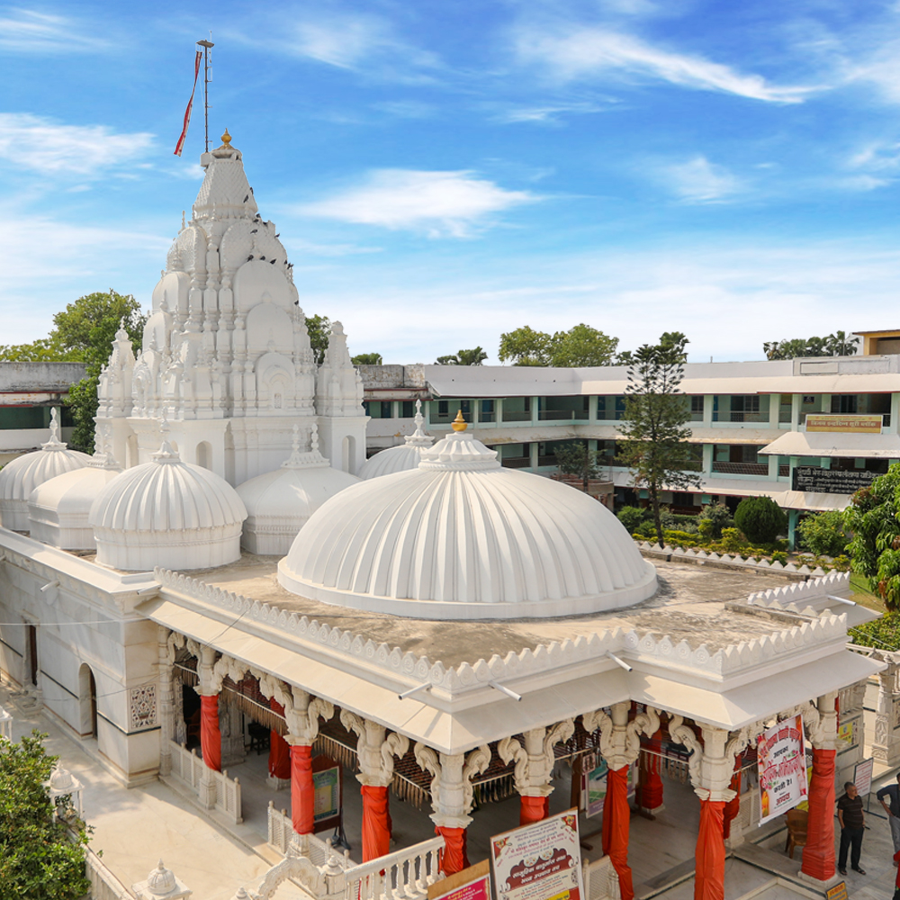
The fort houses a number of religious and historic monuments such as the Tomb of Pir Shah Nufa (died 1497), Palace of Shah Suja, Tomb of Mulla Muhammad Said (died 1704 CE), the Kashtaharini Ghat on the Ganges River, Chandisthana (an ancient temple) and an 18th century British cemetery. In recent times, a famous School of Yoga has been established here.
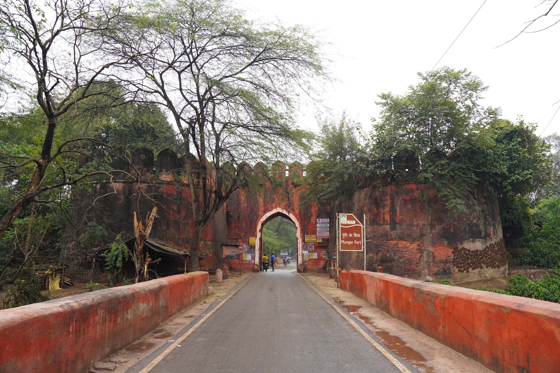
Under the Mughal rule, the fort was substantially expanded as a strong military fortification. The fort was an impressive structure with massive gates, one of which had been a strong fortification with square towers, with a deep moat. The moat was 175 feet (53 m) in width, surrounding the land side of the fort, thus making it strategically formidable. It opens to the Ganges river (which is 2 kilometres (1.2 mi) wide here but crossed only by boats) at either end thus enhancing the fort's security.
The fort is spread over an area of 222 acres (90 ha) over rocky hills with a peripheral length of 2.5 miles (4.0 km). The fort has 4 feet (1.2 m) thick inner walls while the outer walls are 12 feet (3.7 m) thick forming the fortification, which is 30 feet (9.1 m) thick. The intervening space of 14 feet (4.3 m) between the inner and outer walls is filled with earth. The Ganges river hugs the fort walls on the west and partly in the north. On the landward side, there is 175 feet (53 m) wide moat, which acts as a defense to the fortifications. There are four entry gates, within the octagonal fortress, with ramparts. The main gateway, called the Lal Darwaja, is still in good shape, even though the rest of the fort is mostly in ruins. This gate has a carved stone, which is said to belong to a Hindu or a Buddhist structure.
Photo Gallery
.jpg)
.jpg)
.jpg)
.jpg)
At a Glance
Munger Fort is a historical stronghold that has stood the test of time, witnessing several dynastic reigns, including the Mauryas, Khiljis, Mughals, and British. Perched on the banks of the Ganges River, this massive structure is an architectural marvel that showcases a blend of Hindu and Islamic styles. The fort is home to several ancient structures, including the Tomb of Pir Shah Nufa, a revered Sufi saint. The fort’s location on a rocky hill provides breathtaking views of the surrounding landscape.
Within the fort complex lies the famous Kastaharni Ghat, where people take holy dips, believing the waters have purifying properties. Another major attraction is the Chandisthan Temple, dedicated to Goddess Chandi. The fort has served various purposes over the centuries, from being a strategic military outpost to a center of learning and spirituality. Today, it stands as a proud reminder of Bihar’s rich history and architectural brilliance.
Best Time to Visit : October to March.
Electronic Gadgets : Mobile, Camera, Electronic Gadgets Allowed.
Travel Information

Location
Munger, Bihar - 811201

Cultural Etiquette
Respect the historical site, avoid defacing structures.

Local Transport
Auto-rickshaws and taxis from Munger town.